Samples / Pad sites, ground leases and tenant representation
Freeway retail node, chains only
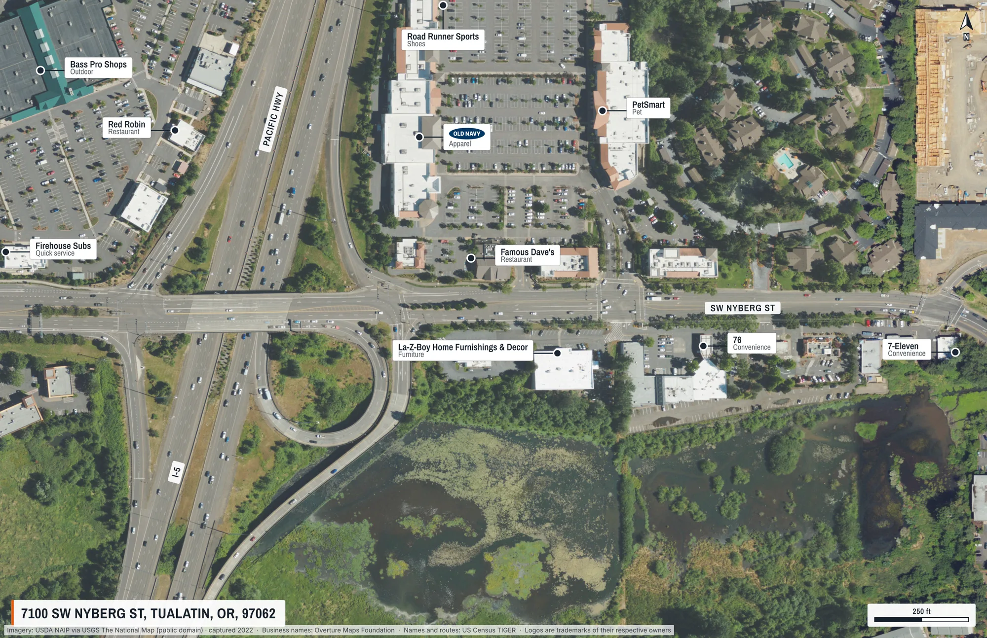
A freeway interchange and the retail around it, with recognised chains only and the road names set along the roads.
What this shows
- brandsOnly keeps the recognised chains and drops everything else, so the page reads as co-tenancy.
- Labels placed around each other and around the title block and scale bar, with leaders back to each building.
- Oregon publishes no statewide parcels, so none are drawn: the map says what it has, not more.
What came back
- Page
- 11 × 17 in landscape, true scale
- Frame
- 800 m × 518 m on the ground
- Imagery
- USDA NAIP via USGS The National Map (public domain), captured 2022
- Drawn
- 16 labels, outlines and page elements, placed automatically
The request that made it
{
  "address": "7100 SW Nyberg St, Tualatin, OR",
  "groundWidthM": 800,
  "orientation": "landscape",
  "autoLabel": {
    "maxTenants": 10,
    "maxRoads": 3,
    "brandsOnly": true
  }
}
Send it to POST https://maps.aeralas.com/api/v1/maps/check to see, free, what would be drawn and whether anything had to compromise. Send it to POST https://maps.aeralas.com/api/v1/maps for the print file as a PDF. The same tools are on the MCP server at https://maps.aeralas.com/mcp.
No code? Enter the address in the editor and it drafts the same labels for you to edit.