Samples / Land brokerage, due diligence and site engineering
Riverside tract with flood zones and wetlands
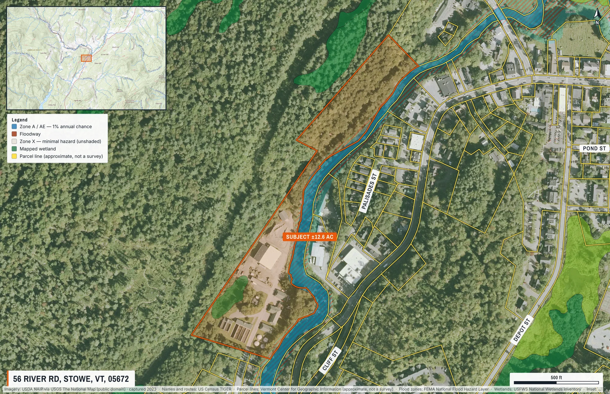
A riverside tract outlined from the assessor record, with the FEMA floodplain and mapped wetlands drawn under it and a legend that matches.
What this shows
- The tract outlined from Vermont’s parcel data, with its recorded acreage returned to the caller.
- FEMA flood hazard zones and the National Wetlands Inventory, composited under the labels.
- A locator inset placing the frame in the wider valley, and a legend generated from the layers actually drawn.
What came back
- Page
- 11 × 17 in landscape, true scale
- Frame
- 1.1 km × 712 m on the ground
- Imagery
- USDA NAIP via USGS The National Map (public domain), captured 2023
- Parcel
- No. 621-195-12937, recorded at 56 RIVER RD, 12.59 acres. Found by address, from the Vermont Center for Geographic Information.
- Drawn
- 10 labels, outlines and page elements, placed automatically
The request that made it
{
  "address": "56 River Rd, Stowe, VT",
  "groundWidthM": 1100,
  "orientation": "landscape",
  "subjectParcel": {
    "label": "SUBJECT ±12.6 AC"
  },
  "overlays": [
    "fema-flood",
    "nwi-wetlands",
    "parcels"
  ],
  "autoLabel": {
    "mode": "site",
    "maxTenants": 0,
    "maxRoads": 4
  },
  "pageElements": {
    "titleBlock": true,
    "northArrow": true,
    "scaleBar": true,
    "locatorInset": true,
    "insetZoomOut": 16
  }
}
Send it to POST https://maps.aeralas.com/api/v1/maps/check to see, free, what would be drawn and whether anything had to compromise. Send it to POST https://maps.aeralas.com/api/v1/maps for the print file as a PDF. The same tools are on the MCP server at https://maps.aeralas.com/mcp.
No code? Enter the address in the editor and it drafts the same labels for you to edit.