Samples / Retail leasing and investment sales
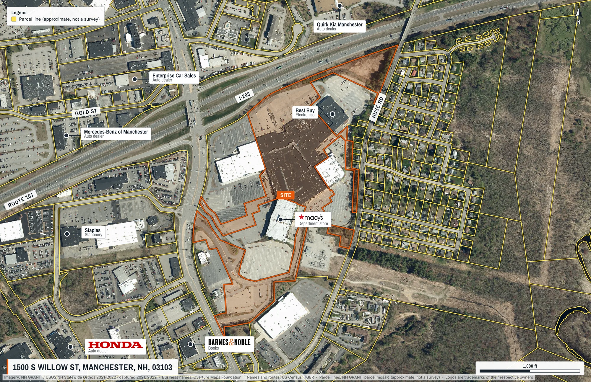
Shopping centre with its lot outlined
A regional mall located by street address, centred on its own tax parcel, with the anchors and neighbours drafted from open data.
What this shows
- The lot is found by the address the state records for it, then the map is centred on it. The geocoder alone puts this address on a highway ramp.
- Anchors and neighbouring chains drafted automatically, with public-domain logos where one exists.
- Parcel lines for every lot in the frame, and road names set along the roads.
What came back
- Page
- 11 × 17 in landscape, true scale
- Frame
- 1.8 km × 1.2 km on the ground
- Imagery
- NH GRANIT / USGS NH Statewide Orthos 2021-2022, captured 2021 and 2022
- Parcel
- No. 666A-3, recorded at 1500 S WILLOW ST, 34.28 acres. Found by address, from the NH GRANIT parcel mosaic.
- Drawn
- 17 labels, outlines and page elements, placed automatically
The request that made it
{
  "address": "1500 S Willow St, Manchester, NH",
  "groundWidthM": 1800,
  "orientation": "landscape",
  "subjectParcel": {
    "label": "SITE"
  },
  "overlays": [
    "parcels"
  ],
  "autoLabel": {
    "maxTenants": 8,
    "maxRoads": 4
  }
}
Send it to POST https://maps.aeralas.com/api/v1/maps/check to see, free, what would be drawn and whether anything had to compromise. Send it to POST https://maps.aeralas.com/api/v1/maps for the print file as a PDF. The same tools are on the MCP server at https://maps.aeralas.com/mcp.
No code? Enter the address in the editor and it drafts the same labels for you to edit.